Workshop Series by Geoinformatics Center __________________________________________________________________
Background
Delivering the data is one of the key parameters in giving the output for the rightmost decision-making. In the past years, The Geoinformatics Center is a pioneer in harmonizing the information on the earth’s surface into a comprehensive piece of information. The Geoinformatics Center (GIC) is focusing on the expertise range of disaster management, environment, and agriculture. With numerous working ranges in Asia and Europe, GIC widespread the harmonization of the framework within the utility of spatial aspects and the issues.
Responding to achieving sustainability in community aspects, GIC intervenes with the expertise in capacity building for communities with current technology. In this workshop, we deliver a special session to gain more knowledge in the power of geospatial analysis, machine learning, satellite analysis, and artificial intelligence in assisting the resilient community.
Program
No. | Agenda | Time | Remarks |
1. | Opening remarks: A brief introduction to Geoinformatics Centerby Dr Manzul K Hazarika, Director of GIC | 13.00 – 13.15 | |
2. | Geoinformatics in Disaster Management: Disaster Response for the Resilient Communitiesby Mr. Syams Nashrrullah, Research Specialist of GICMr. Anish R Shakya, Research Associate of GIC | 13.15 – 13.45 | |
3. | Integrating Plastic Waste Management using Digital Technologies and Enabling Smart Monitoringby Dr. Kittiphon Boonma, Research Specialist of GICMs Aprilia Nidia Rinasti, Research Associate of GIC | 13.45 – 14.15 | |
Break and networking hours | 14.15 – 14.45 | ||
4. | Demonstration of Spatial Information for Decision Making· RiskChanges, a platform for decision-making in multi-hazard risk assessment· pLitter, a smart plastic litter monitoring in the environment. | 14.45 – 15.15 | |
5. | PIESAT Session: The Latest Invention in Aerial Imagery for Earth Observation data | 15.15 – 16.00 | TBC |
Booth
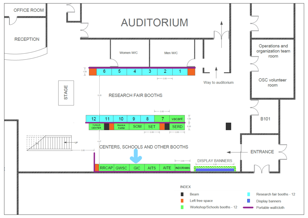
The booth will be open for all three days of the workshop and located in the same location as the expo. Please find the attachment for the layout of the expo below.
The location for GIC and PIESAT will be at the position with the arrow.


